Your Aviation Weather Companion
AirportWX
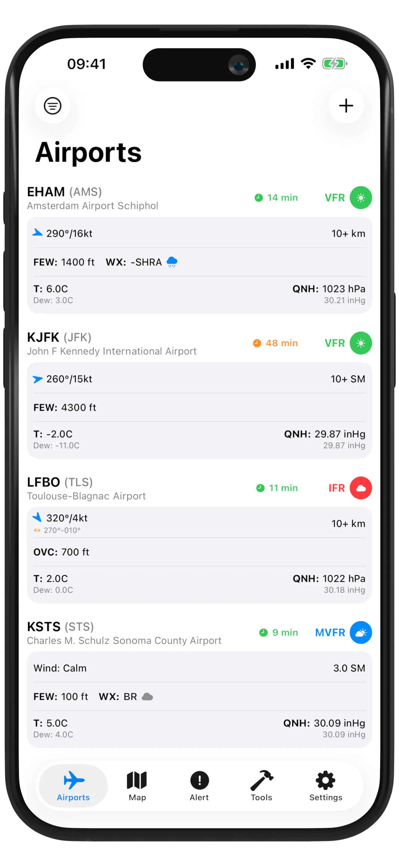
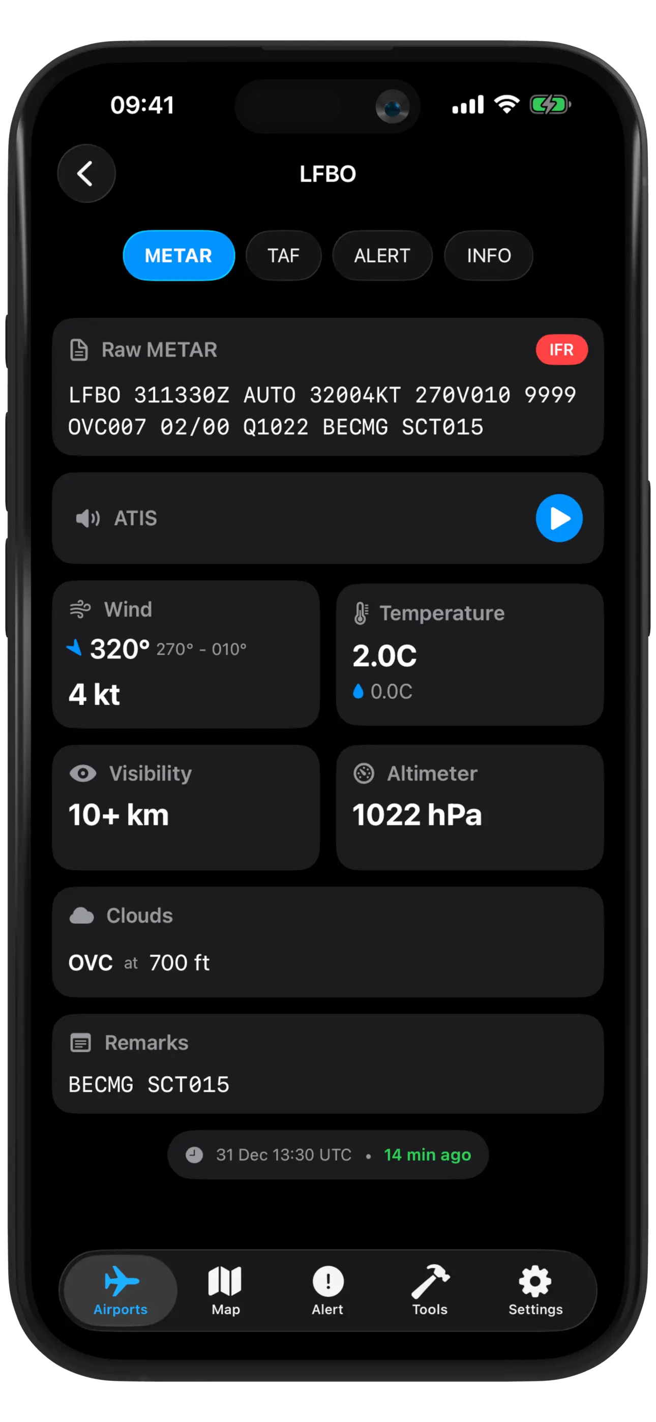
Real-time METAR, TAF, and weather alerts for 48,000+ airports worldwide. Designed for pilots, flight simulator and aviation enthusiasts.
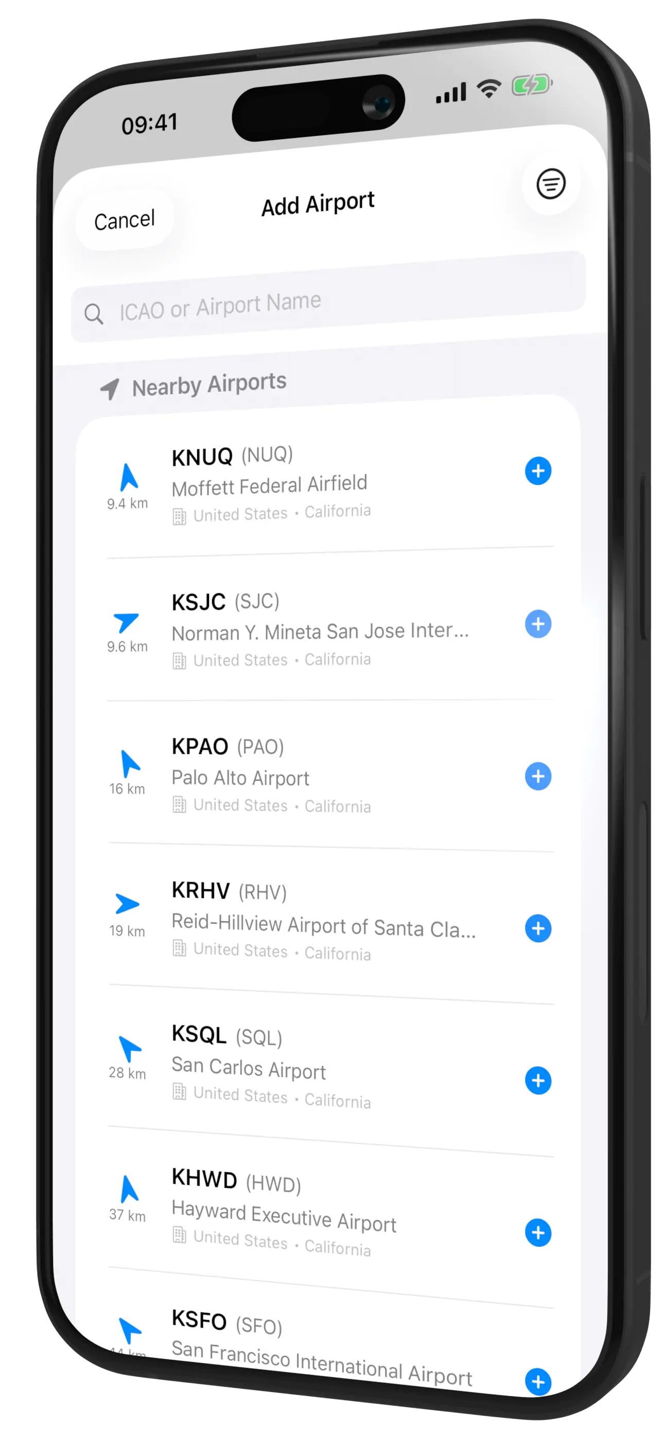
48,000+ Airports
Worldwide coverage
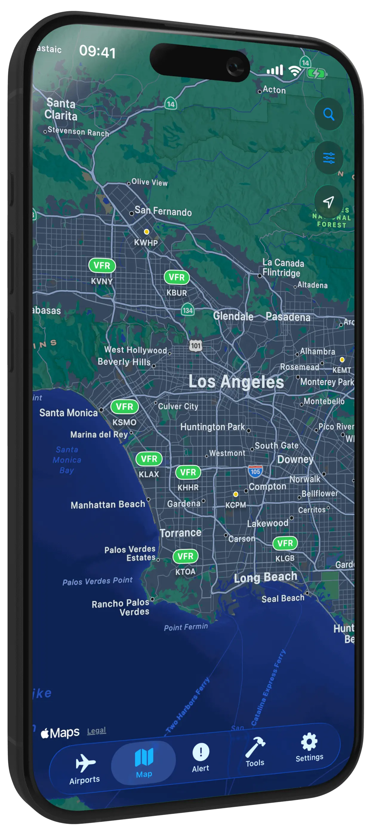
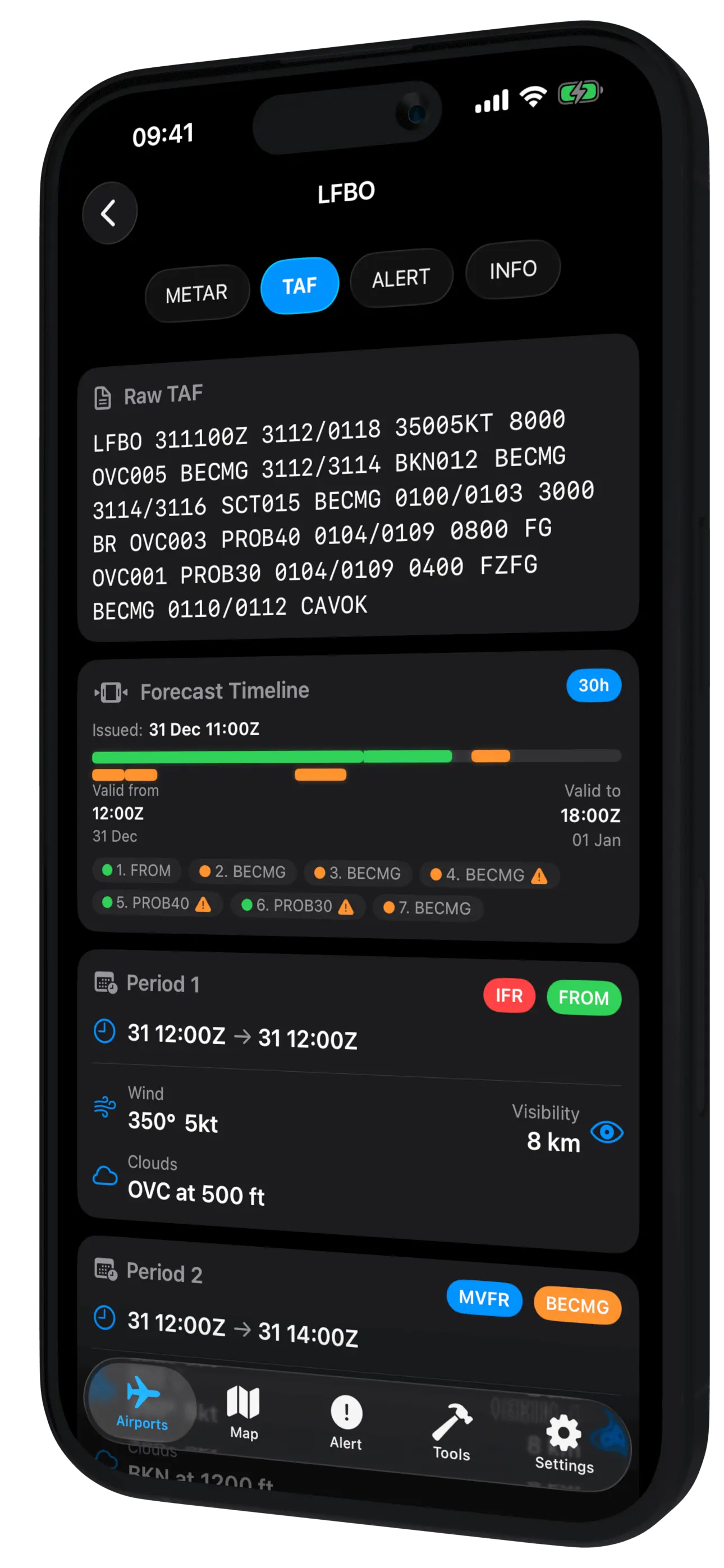
Real-Time Data
Live weather updates
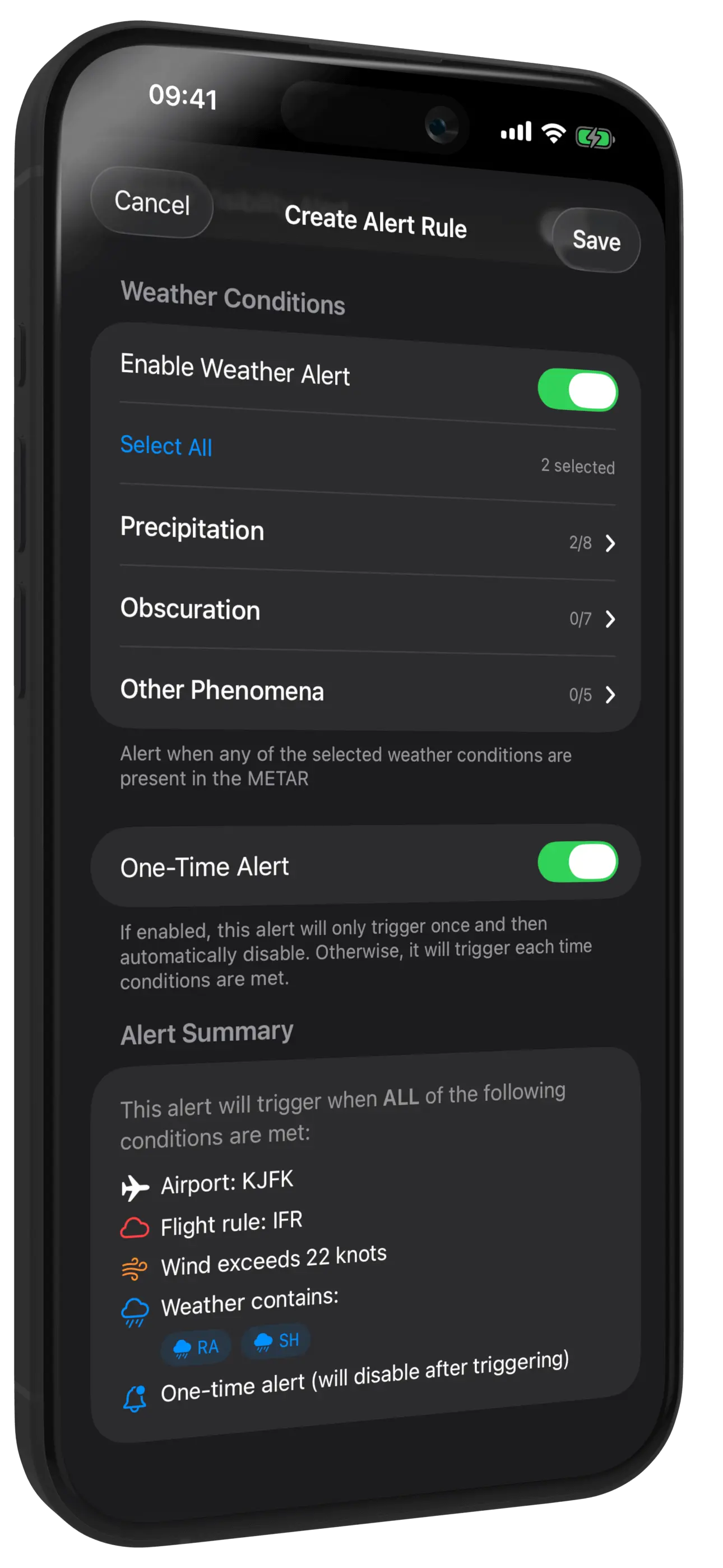
Smart Alerts
Never miss changes